vue+openlayer+天地图,初始化一个地图
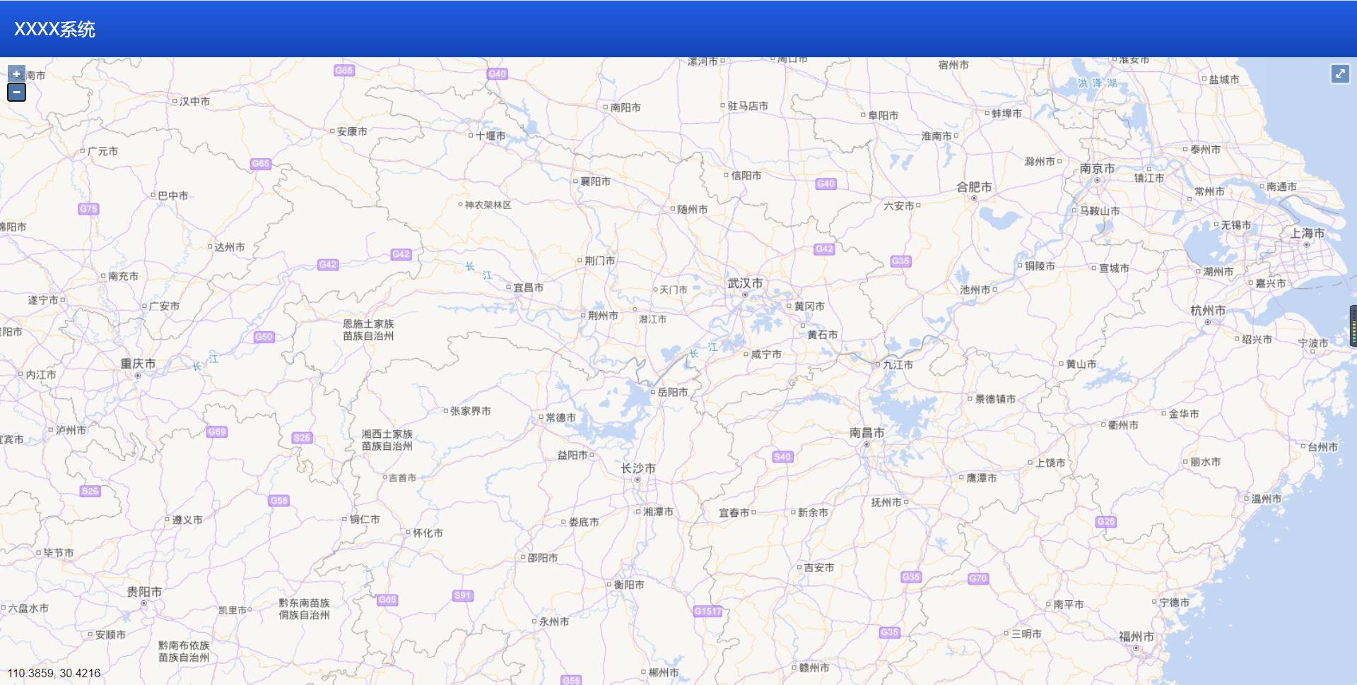
// 效果图
// 需要在项目安装openlayer
"ol": "^6.1.1"
把这个复制进package.json 文件的 “dependencies” 里面npm install 重启项目
把这个复制进package.json 文件的 “dependencies” 里面npm install 重启项目
<template>
<div id="map" ref="rootmap">
<div id="mouse-position"></div>
</div>
</template>
<script>
import 'ol/ol.css'
import {get as getProjection} from 'ol/proj'
import {getWidth, getTopLeft} from 'ol/extent'
import View from 'ol/View'
import Map from 'ol/Map'
import TileLayer from 'ol/layer/Tile'
import WMTS from 'ol/source/WMTS'
import WMTSTileGrid from 'ol/tilegrid/WMTS'
import VectorSource from 'ol/source/Vector'
import VectorLayer from 'ol/layer/Vector'
import Feature from 'ol/Feature'
import Point from 'ol/geom/Point'
import olStyle from 'ol/style/Style'
import olstyleIcon from 'ol/style/Icon'
import olstyleText from 'ol/style/Text'
import olstyleFill from 'ol/style/Fill'
import olstyleStroke from 'ol/style/Stroke'
import {defaults as defaultControls} from 'ol/control'
import FullScreen from 'ol/control/FullScreen'
import MousePosition from 'ol/control/MousePosition'
import {createStringXY} from 'ol/coordinate'
/* eslint-disable */
export default {
name: 'OlMap',
props: ['tableData', 'targetPoint'],
data () {
return {
map1: null,
view: null,
vectorSource: null,
mousePositionControl: null
}
},
mounted () {
// 渲染地图
var projection = getProjection('EPSG:4326')
var projectionExtent = projection.getExtent()
var size = getWidth(projectionExtent) / 256
var resolutions = new Array(18)
var matrixIds = new Array(18)
for (var z = 1; z < 19; ++z) {
resolutions[z] = size / Math.pow(2, z)
matrixIds[z] = z
}
var webKey = 'xxxxxxxxxxx' // 这里需要改为你的key值
var wmtsUrl_1 = 'http://t{0-7}.tianditu.gov.cn/vec_c/wmts?tk=' // 矢量底图
var wmtsUrl_2 = 'http://t{0-7}.tianditu.gov.cn/cva_c/wmts?tk=' // 矢量注记
this.view = new View({
center: [112.55, 37.87],
projection: projection,
zoom: 10
})
this.mousePositionControl = new MousePosition({
coordinateFormat: createStringXY(4),
projection: 'EPSG:4326',
className: 'custom-mouse-position',
target: document.getElementById('mouse-position'),
undefinesHTML: ' '
})
this.map1 = new Map({
controls: defaultControls().extend([this.mousePositionControl]),
layers: [
new TileLayer({
opacity: 0.7,
source: new WMTS({
url: wmtsUrl_1 + webKey,
layer: 'vec',
matrixSet: 'c',
format: 'tiles',
style: 'default',
projection: projection,
tileGrid: new WMTSTileGrid({
origin: getTopLeft(projectionExtent),
resolutions: resolutions,
matrixIds: matrixIds
}),
wrapX: true
})
}),
new TileLayer({
opacity: 0.7,
source: new WMTS({
url: wmtsUrl_2 + webKey,
layer: 'cva',
matrixSet: 'c',
format: 'tiles',
style: 'default',
projection: projection,
tileGrid: new WMTSTileGrid({
origin: getTopLeft(projectionExtent),
resolutions: resolutions,
matrixIds: matrixIds
}),
wrapX: true
})
})
],
target: 'map',
view: this.view
})
this.vectorSource = new VectorSource({
features: []
})
// 初始化矢量图层
var vectorLayer = new VectorLayer({
source: this.vectorSource
})
var fullScreenControl = new FullScreen()
// 将矢量图层添加到map
this.map1.addLayer(vectorLayer)
this.map1.addControl(fullScreenControl) // 添加全屏
},
watch: {
tableData (n, o) {
this.vectorSource.clear()
for (var i = 0; i < n.length; i++) {
this.addMarker(n[i].username, n[i].lon, n[i].lat)
}
},
targetPoint (n, o) {
this.vectorSource.clear()
this.addMarker(n.username, n.lon, n.lat)
this.view.animate({
center: [n.lon, n.lat],
duration: 1000,
zoom: 12
})
}
},
methods: {
/*
*标注点
*/
addMarker (username, lon, lat) {
var newFeature = new Feature({
geometry: new Point([lon, lat]),
name: username
})
// 设置样式
newFeature.setStyle(createLabelStyle(newFeature))
// 将当前要素加入矢量数据源
this.vectorSource.addFeature(newFeature)
// 创建标注的样式
function createLabelStyle (fe) {
// 返回一个样式
return new olStyle({
image: new olstyleIcon({
anchor: [0.5, 70],
anchorOrigin: 'top-right',
anchorXUnits: 'fraction',
anchorYUnits: 'pixels',
offsetOrigin: 'top-right',
opacity: 0.75,
scale: 0.5,
src: '../../static/images/locate.png'
}),
text: new olstyleText({
textAlign: 'center',
textBaseline: 'middle',
font: 'normal 20px 微软雅黑',
text: fe.get('name'),
fill: new olstyleFill({color: '#000'}),
scale: 0.7,
stroke: new olstyleStroke({color: 'pink', width: 2})
})
})
}
}
}
}
</script>
<style>
#map{
height:100%;
}
#mouse-position {
float: right;
position: absolute;
left:10px;
bottom: 5px;
width: 200px;
height: 20px;
/* 将z-index设置为显示在地图上层 */
z-index: 2000;
}
/* 显示鼠标信息的自定义样式设置 */
.custom-mouse-position {
color: black;
font-size: 16px;
font-family: "Arial";
}
</style>

 浙公网安备 33010602011771号