openlayers一:显示地图与鼠标地理坐标
openlayers两个好用的开源JS互动地图库之一,另一个是leaflet。
openlayers的特点是是大而全,自身包含绝大多数功能,文档好看。
leaflet是小而美,自身小,但支持扩展,好用扩展很多。
谷歌地图:
从上面可以获取到谷歌地图瓦片图的连接为:
http://www.google.cn/maps/vt?lyrs=y@802&gl=cn&x={x}&y={y}&z={z}
那么要显示地图,只需:
 1 this.tileLayer = new ol.layer.Tile({
 2      source: new ol.source.XYZ({
 3          attributions: new ol.Attribution({
 4          html: '作者: 愤怒的小明'
 5          }),
 6          url: 'http://www.google.cn/maps/vt?lyrs=y@802&gl=cn&x={x}&y={y}&z={z}'
 7      })
 8 });
 9 this.map.addLayer(this.tileLayer);
10 //地图默认是莫卡托投影,从经纬度转成莫卡托座标
11 var center = ol.proj.fromLonLat([113.2569444444, 23.1336111111]);
12 //设置地图中心
13 var view = this.map.getView();
14 view.setCenter(center);
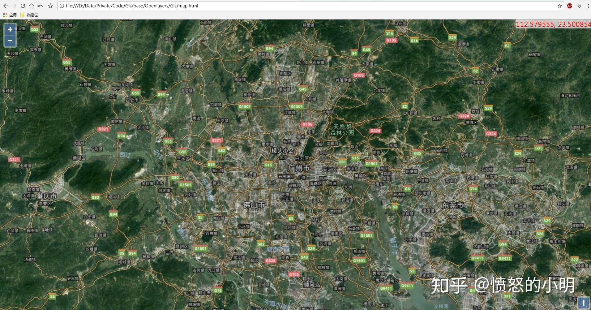
鼠标漂浮显示当前位置:
1 var mousePositionControl = new ol.control.MousePosition({ 2 coordinateFormat: ol.coordinate.createStringXY(6), 3 projection: 'EPSG:4326', 4 className: 'custom-mouse-position', 5 target: document.getElementById('mouse-position'), 6 undefinedHTML: ' ' 7 }); 8 this.map.addControl(mousePositionControl);
最终效果:
整体代码:
链接: https://pan.baidu.com/s/1WShiQh98EhtlNuw57jsEQA 密码: dfxz


 浙公网安备 33010602011771号