Tiles in Google Maps:Coordinates、Tile Bounds and Projection
Click on a tile to display the numerical boundaries...
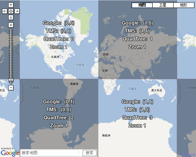
Addressing tiles: same tile bounds with different indexes
Google Maps, Microsoft Virtual Earth, Yahoo Maps, and other commercial API providers as well as OpenStreetMap and OpenAerialMap are using the same projection and tiling profile and tiles are therefore compatible. The extents of all tiles as well as the zoom levels (resolution in meters per pixel) are predefined for the whole Earth.
Difference is only in the way how the equivalent tiles are indexed. There are three main systems of tile adressing: Google XYZ, Microsoft QuadTree and from the open-source world comming TMS (Tile Map Service).
全文见:http://www.maptiler.org/google-maps-coordinates-tile-bounds-projection/1.Google - described in the Google Maps API documentation
2.TMS an variant of Google tile addressing, which is used in open-source projects like OpenLayers or TileCache. This system is described in the OSGEO Tile Map Service (TMS) Specification
3.QuadTree - with documentation in the Virtal Earth Tile System from Microsoft