OpenLayers绘制地图,无需外网,内网访问,提高安全性。
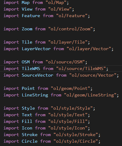
1. 首先引入ol ,npm i --save ol
2. 创建地图
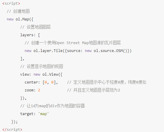
一个地图初步就这样完成了。
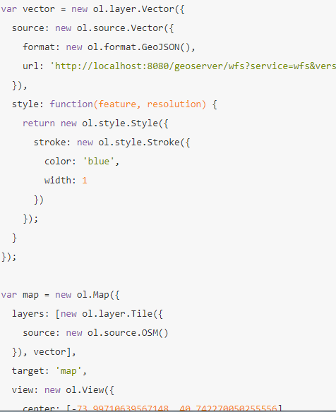
3. 怎么与后台进行交互?
具体参考文档:http://weilin.me/ol3-primer/ch12/12-01-01.html
然后就是配置:
其中的view center 设置就是显示某一局部的中心,就是限制显示局部区域。
4. 自定义加载图标

先定义map,然后把后台数据比如图片,经纬度等放入this.nodeData.set(name,value),
然后在其他地方就通过this.nodeData.get(name)能拿到feature。
5. 地图单击事件
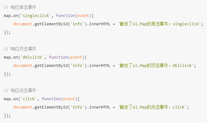
let feature = map.forEachFeatureAtPixel(event.pixel, function (feature, layer) {
             return feature;
     });
这段代码放到点击事件内可以转换可以拿到当前feature的经纬度,图片类型,也可以拿到当前feature的id. 可以进行路由跳转等。
6. 封装feature图标
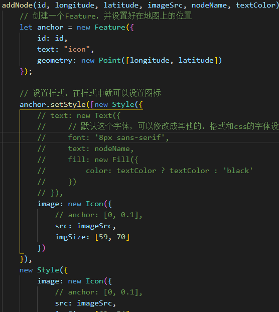
没有anchor,图标将自动处于地理位置的中心,是一个偏移量的api.
anchor.setStyle 动态修改icon. this.layer.addFeature(anchor);
7. 地图连线和报警
let line = new Feature({
                    id: id,
                    geometry: new LineString(
                        [[sLongitude, sLatitude], [eLongitude, eLatitude]])
                });
                line.setStyle(new Style({
                    text: new Text({
                        // 默认这个字体,可以修改成其他的,格式和css的字体设置一样
                        font: '16px sans-serif',
                        text: lineName,
                        placement: 'line',
                        textBaseline: 'top',
                        fill: new Fill({
                            color: color ? color : 'blue'
                        })
                    }),
                    stroke: new Stroke({
                        width: color === 'red' ? 2 : 1,
                        color: color ? color : 'blue'
                    })
                }));
                // 添加到之前的创建的layer中去
                this.layer.addFeature(line);
详细请参考此中文文档: http://weilin.me/ol3-primer/index.html
作者:人参,每篇随笔皆原创(除非注明原作者的随笔),欢迎指正!

 浙公网安备 33010602011771号