
Ivory Coast Map

Fun Facts about Cote d'Ivoire
- The Republic of Cote d'Ivoire (previously known as the Ivory Coast) is a west African country of over 20 million citizens.
- The land was once called the 'teeth coast' due to the trade in ivory.
- Independence from France in 1960 is celebrated on August 7th each year with military processions and fireworks.
- The Ivory Coast is the world's largest exporter of cocoa, which is used to make chocolate.
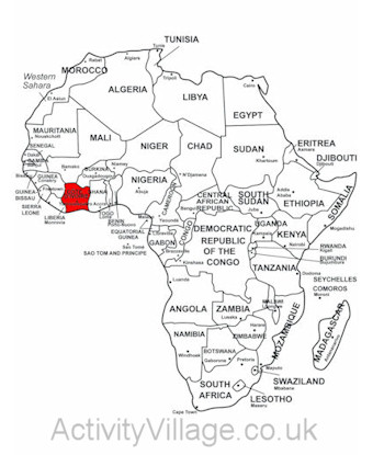
Cote d'Ivoire on map of Africa. Printable here.
- Abidjan is the third largest French speaking city in the world with 3,800,000 residents - although the country's capital is now inland at Yamoussoukro.
- The Tai National Park is an ancient forest and home to the pygmy hippopotamus.
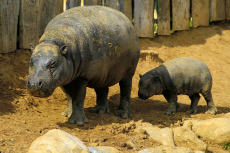
Pygmy hippos - mother and baby
The West African CFA franc (French: franc CFA; Portuguese: franco CFA or simply franc, ISO 4217 code: XOF) is the currency of eight independent states in West Africa: Benin, Burkina Faso, Guinea-Bissau, Ivory Coast, Mali, Niger, Senegal and Togo.
The Cote d'Ivoire Flag

The flag of the Ivory Coast consists of three equally sized vertical stripes coloured orange, white and green, representing the land, peace and hope respectively. The tricolour design mimics that of the French national flag, the Ivory Coast’s former colonial power.

 浙公网安备 33010602011771号