

雷达气象相关词汇(一 扫描模式)
参考自https://www.radartutorial.eu/15.weather/wr20.en.html
https://en.wikipedia.org/wiki/Plan_position_indicator
PPI(平面位置显示)
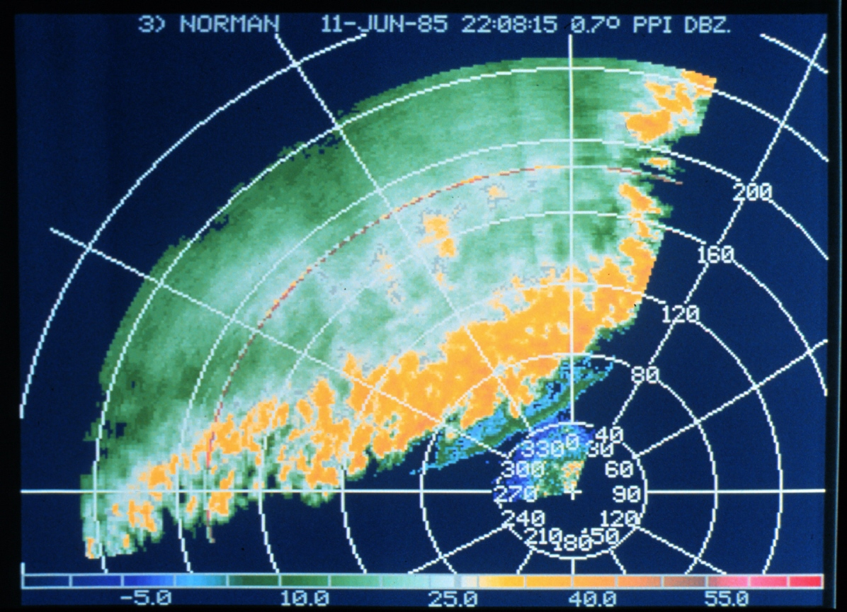
PPI图。0.7°仰角。可以看到飑线
RHI(距离高度显示)
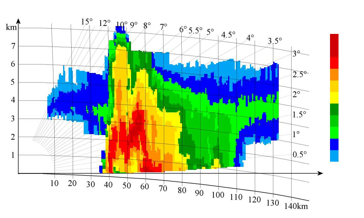
RHI图
等高面平面位置显示图CAPPI
A CAPPI (Constant Altitude PPI) is a horizontal, two-dimensional representation of radar measurement variables at a certain height. A CAPPI is calculated and interpolated from several PPI measurements at different elevations. On a PPI- Scope, the different heights will be mostly represented by color variations. A so-called pseudo-CAPPI (pCAPPI) differs from a CAPPI in that additional values in the far zone are extrapolated.
体积恒定-等高面平面位置显示图Vol-CAPPI (“三视图”)
另一个显示选项称为体积恒定-等高面显示图 (Volume-CAPPI),允许在所有三个横截面中进行清晰的回波分配。除了底层平面图之外,还显示立面图(对应于从东到西的侧立面图)和单个横向立面图(对应于从北到南的侧立面图)。借助十字光标,可以选择这些横截面的位置。Another display option is called Volume Constant Altitude Plan Position Indicator (Volume-CAPPI) and allows a clear echo assignment in all three cross-sections. In addition to a floor plan, an elevation (corresponds to a side elevation from east to west) and a single cross elevation (corresponds to a side elevation from north to south) are shown. With the help of a crosshair-cursor, the positions of these cross-sections can be selected.
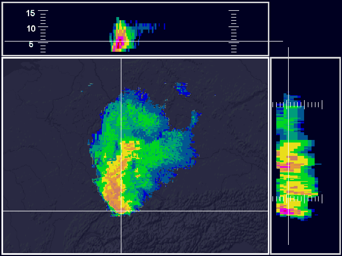
Vol-CAPPI-显示
最大等高面平面位置显示图MAX-CAPPI
In a MAX-CAPPI (Maximum Constant Altitude Plan Position Indicator) maxima of CAPPI data from different heights are displayed. This is done on the one hand by a vertical maximum projection in an (image) elevation, on the other hand by horizontal maximum projections from south to north or from west to east in side elevations. In the side elevations, the lateral scale indicates the height in km. In a MAX-CAPPI mostly reflectivities are shown.
多站点雷达拼图Composites across multiple sites
Combining the radar images of different locations into a composite image opens up further possibilities for weather analysis and forecasting. In most cases, only local reflectivity composites are further processed across locations. The advantage is a large-scale overview. The disadvantage is the poorer accuracy compared to local products.
垂直液态水积分Vertically Integrated Liquid (VIL)
Vertically Integrated Liquid (VIL) is the total amount of rain that would fall if all the liquid water in a column within a rain cloud (usually a thunderstorm) reached the surface of the earth. Basically, all water quantities estimated on the basis of reflectivity are added over a grid-like distributed unit of area.
VIL is not observed or measured, but calculated based on the reflectivity measured by the radar. Thus, everything that influences the reflectivity has an effect on the VIL.

 浙公网安备 33010602011771号