新数据介绍
spectra_truth_lab波长是200-2500 1nm为单位。
muufl_gulfport_campus_1波长是367.7大部分含有小数。
但是truth只有四个
端元应该是八种布的谱线。
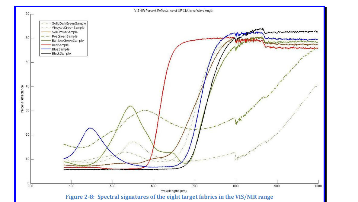
但是wave_truth_campus_1和wave_truth_campus_3就4种谱线Four colors were chosen exclusively for the purpose of creating the atmospheric modeling targets discussed previously. The colors chosen for these targets were Bamboo Green, Red, Blue, and Black. This choice of colors gave us a wide spread of reflectance values within the visible spectrum in which to evaluate the atmospheric modeling. The remaining four colors chosen were used in the endmember detection targets. These colors were Solid Dark Green, Vineyard Green, Soil Brown, and Pea Green.
但代码hs2rgb是,brown,dark green,faux vineyard green,pea green
绿线和黄线分别是spectra_truth_campus_1,spectra_truth_campus_3分别是黄线和绿线,红线spectra_truth_lab
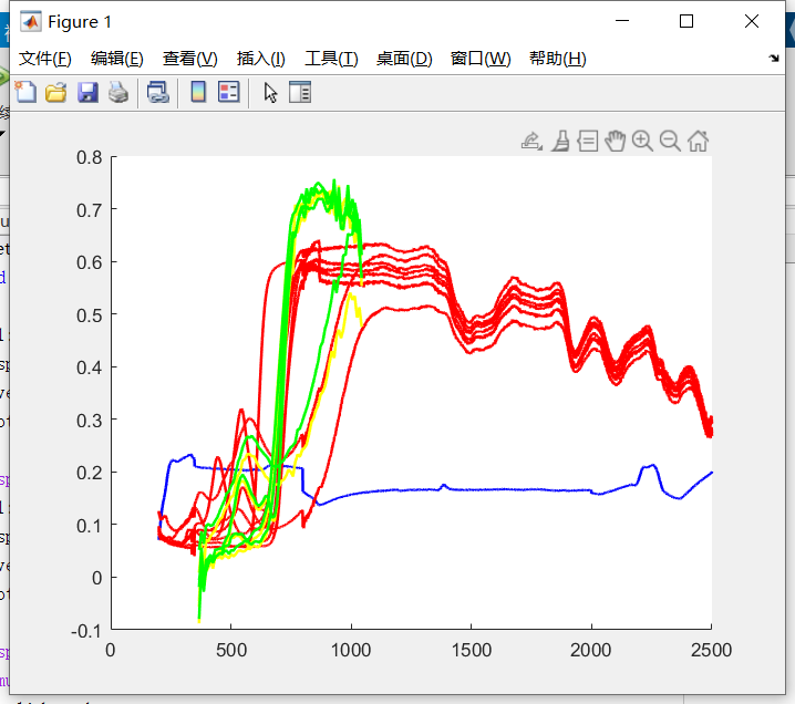
spectra_truth_campus_3只有4条72维度的谱线
gulfport_wavelength72维的波长范围
spectra_truth_lab8个端元及1个baseline的谱线蓝色是Baseline。The spectral signatures from samples of each of the 8 fabrics were then measured with a Cary500 spectrophotometer using 1nm resolution in the range of 200-2500 nm.
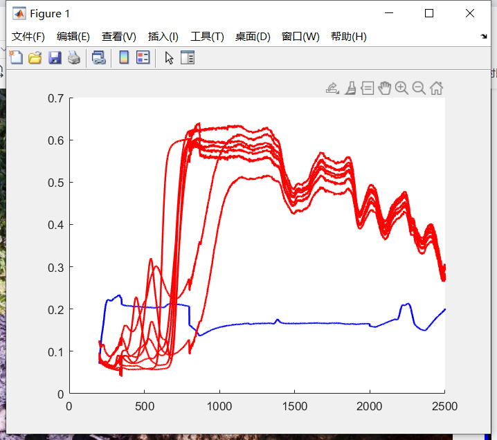
muufl_gulfport_campus_1
info结构
description俩个变量一个描述拍摄时间一个描述
位置、分辨率、高处。

目标_ UTMx:UTM东距
目标_UTMy:UTM北距
东距和北距用于描述地理笛卡尔坐标系里的任意点的坐标。东距描述X坐标,北距描述Y坐标。这一对直角坐标通常在大地基准面上测量得到,单位是米。(后面的翻译略)
When using the Universal Transverse Mercator coordinate system, northing is the distance to the equator, while easting is the distance to the "false easting", which is uniquely defined in each UTM zone.
Targets_Lat:纬度度数
Targets_Lon:经度
Targets_ID:目标的数字标识符(1到64)
gen_all4_target_data是修改标签把brown、dark green、faux vineyard green、pea green把这些标签类型改为all4types。
光谱的波带是72。用的是Lambertian Reflectance:使不同拍摄角度有相同反射率

一共8种颜色,由棉物。

数据问题:

Vineyard Green有问题。
5次收集的数据
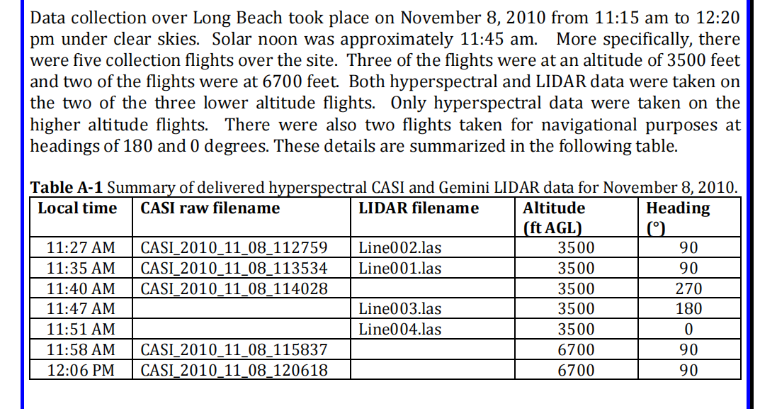
第二种数据问题

背景端元定义:
spectra_truth_campus_1:4个72维度的反射率。
spectra_truth_campus_3:4个72维度的反射率。
gulfport_wavelength:波长。
muufl_gulfport_campus_3_all4TypeLabel
load('muufl_gulfport_campus_3_all4TypeLabel')
w=hsi.RGB
figure(1);
imshow(w);
把RGB可视化了,RGB是3维的RGB通道。
spectra_truth_campus_1
muufl_gulfport_campus_1
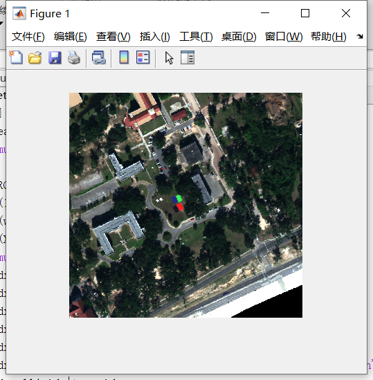
muufl_gulfport_campus_2
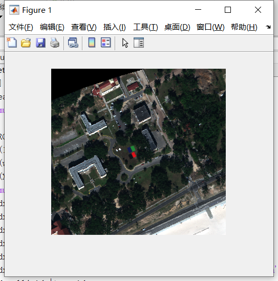
muufl_gulfport_campus_3
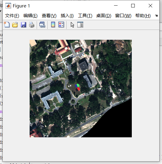
muufl_gulfport_campus_4
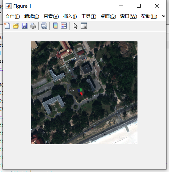
muufl_gulfport_campus_5
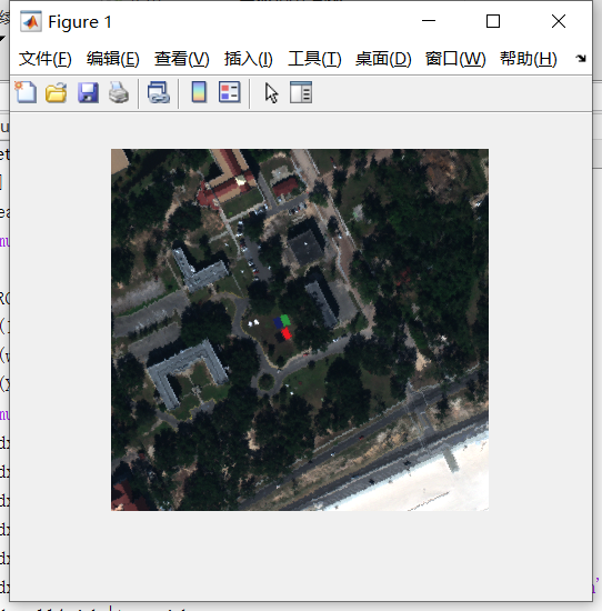
hs2rgb(hsi.RGB,hsi.info.wavelength)
把RGB图片变为黑白的
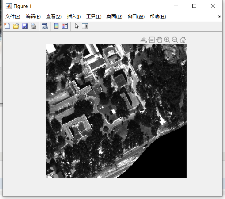
* muufl_gulfport_campus_w_lidar_1.mat
campus subimage #1 (3500ft elev), includes coregistered LiDAR DEMs, includes image registered truth info
* muufl_gulfport_campus_w_lidar_2.mat
campus subimage #2 (3500ft elev), includes coregistered LiDAR DEMs, includes image registered truth info
* muufl_gulfport_campus_3.mat
campus subimage #3 (3500ft elev), includes image registered truth info
* muufl_gulfport_campus_4.mat
campus subimage #4 (6700ft elev), includes image registered truth info
* muufl_gulfport_campus_5.mat
campus subimage #5 (6700ft elev), includes image registered truth info
ft是feet(英尺)的缩写


【推荐】国内首个AI IDE,深度理解中文开发场景,立即下载体验Trae
【推荐】编程新体验,更懂你的AI,立即体验豆包MarsCode编程助手
【推荐】抖音旗下AI助手豆包,你的智能百科全书,全免费不限次数
【推荐】轻量又高性能的 SSH 工具 IShell:AI 加持,快人一步
· 被坑几百块钱后,我竟然真的恢复了删除的微信聊天记录!
· 没有Manus邀请码?试试免邀请码的MGX或者开源的OpenManus吧
· 【自荐】一款简洁、开源的在线白板工具 Drawnix
· 园子的第一款AI主题卫衣上架——"HELLO! HOW CAN I ASSIST YOU TODAY
· Docker 太简单,K8s 太复杂?w7panel 让容器管理更轻松!