maptalks 开发GIS地图(5)maptalks 介绍
41. Distance measure
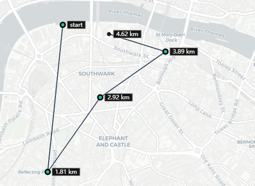
 1   var distanceTool = new maptalks.DistanceTool({
 2     'symbol': {
 3       'lineColor' : '#34495e',
 4       'lineWidth' : 2
 5     },
 6     'vertexSymbol' : {
 7       'markerType'        : 'ellipse',
 8       'markerFill'        : '#1bbc9b',
 9       'markerLineColor'   : '#000',
10       'markerLineWidth'   : 3,
11       'markerWidth'       : 10,
12       'markerHeight'      : 10
13     },
14
15     'labelOptions' : {
16       'textSymbol': {
17         'textFaceName': 'monospace',
18         'textFill' : '#fff',
19         'textLineSpacing': 1,
20         'textHorizontalAlignment': 'right',
21         'textDx': 15,
22         'markerLineColor': '#b4b3b3',
23         'markerFill' : '#000'
24       },
25       'boxStyle' : {
26         'padding' : [6, 2],
27         'symbol' : {
28           'markerType' : 'square',
29           'markerFill' : '#000',
30           'markerFillOpacity' : 0.9,
31           'markerLineColor' : '#b4b3b3'
32         }
33       }
34     },
35     'clearButtonSymbol' :[{
36       'markerType': 'square',
37       'markerFill': '#000',
38       'markerLineColor': '#b4b3b3',
39       'markerLineWidth': 2,
40       'markerWidth': 15,
41       'markerHeight': 15,
42       'markerDx': 20
43     }, {
44       'markerType': 'x',
45       'markerWidth': 10,
46       'markerHeight': 10,
47       'markerLineColor' : '#fff',
48       'markerDx': 20
49     }],
50     'language' : 'en-US'
51   }).addTo(map);
42. Area Measure
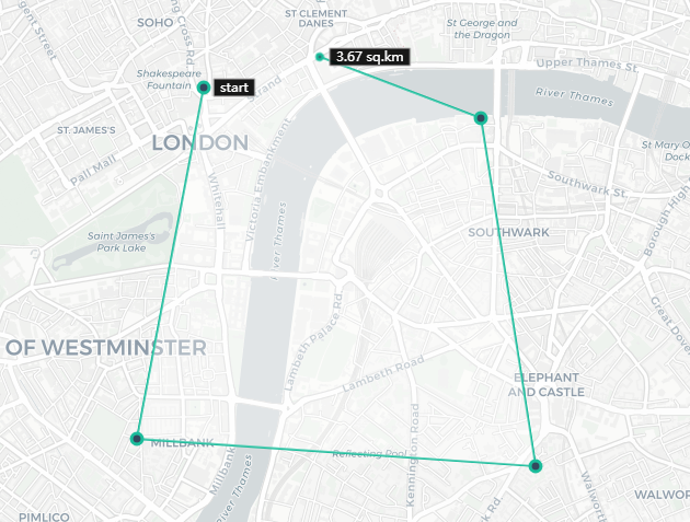
 1   var areaTool = new maptalks.AreaTool({
 2     'symbol': {
 3       'lineColor' : '#1bbc9b',
 4       'lineWidth' : 2,
 5       'polygonFill' : '#fff',
 6       'polygonOpacity' : 0.3
 7     },
 8     'vertexSymbol' : {
 9       'markerType'        : 'ellipse',
10       'markerFill'        : '#34495e',
11       'markerLineColor'   : '#1bbc9b',
12       'markerLineWidth'   : 3,
13       'markerWidth'       : 10,
14       'markerHeight'      : 10
15     },
16     'labelOptions' : {
17       'textSymbol': {
18         'textFaceName': 'monospace',
19         'textFill' : '#fff',
20         'textLineSpacing': 1,
21         'textHorizontalAlignment': 'right',
22         'textDx': 15
23       },
24       'boxStyle' : {
25         'padding' : [6, 2],
26         'symbol' : {
27           'markerType' : 'square',
28           'markerFill' : '#000',
29           'markerFillOpacity' : 0.9,
30           'markerLineColor' : '#b4b3b3'
31         }
32       }
33     },
34     'clearButtonSymbol' :[{
35       'markerType': 'square',
36       'markerFill': '#000',
37       'markerLineColor': '#b4b3b3',
38       'markerLineWidth': 2,
39       'markerWidth': 15,
40       'markerHeight': 15,
41       'markerDx': 22
42     }, {
43       'markerType': 'x',
44       'markerWidth': 10,
45       'markerHeight': 10,
46       'markerLineColor' : '#fff',
47       'markerDx': 22
48     }],
49     language: ''
50   }).addTo(map);
43. Draw Tool
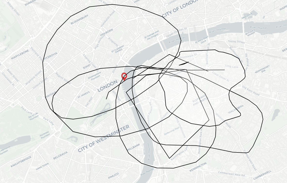
 1 var drawTool = new maptalks.DrawTool({
 2     mode: 'Point'
 3   }).addTo(map).disable();
 4
 5   drawTool.on('drawend', function (param) {
 6     console.log(param.geometry);
 7     layer.addGeometry(param.geometry);
 8   });
 9
10   var items = ['Point', 'LineString', 'Polygon', 'Circle', 'Ellipse', 'Rectangle', 'FreeHandLineString', 'FreeHandPolygon'].map(function (value) {
11     return {
12       item: value,
13       click: function () {
14         drawTool.setMode(value).enable();
15       }
16     };
17   });
18
19   var toolbar = new maptalks.control.Toolbar({
20     items: [
21       {
22         item: 'Shape',
23         children: items
24       },
25       {
26         item: 'Disable',
27         click: function () {
28           drawTool.disable();
29         }
30       },
31       {
32         item: 'Clear',
33         click: function () {
34           layer.clear();
35         }
36       }
37     ]
38   }).addTo(map);
44. mouse contains
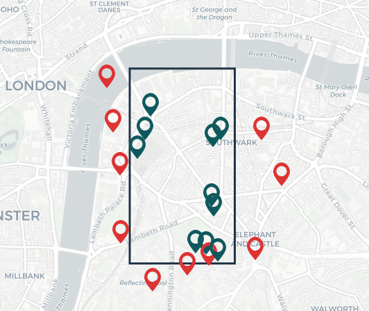
 1   // add markers on map
 2   // set to green if inside the square
 3   // set to red if outside the square
 4   map.on('click', function (e) {
 5     var marker = new maptalks.Marker(e.coordinate);
 6     if (polygon.containsPoint(e.containerPoint)) {
 7       marker.updateSymbol({
 8         markerFill : '#0e595e'
 9       });
10     }
11     marker.addTo(markerLayer);
12   });
45. fly location
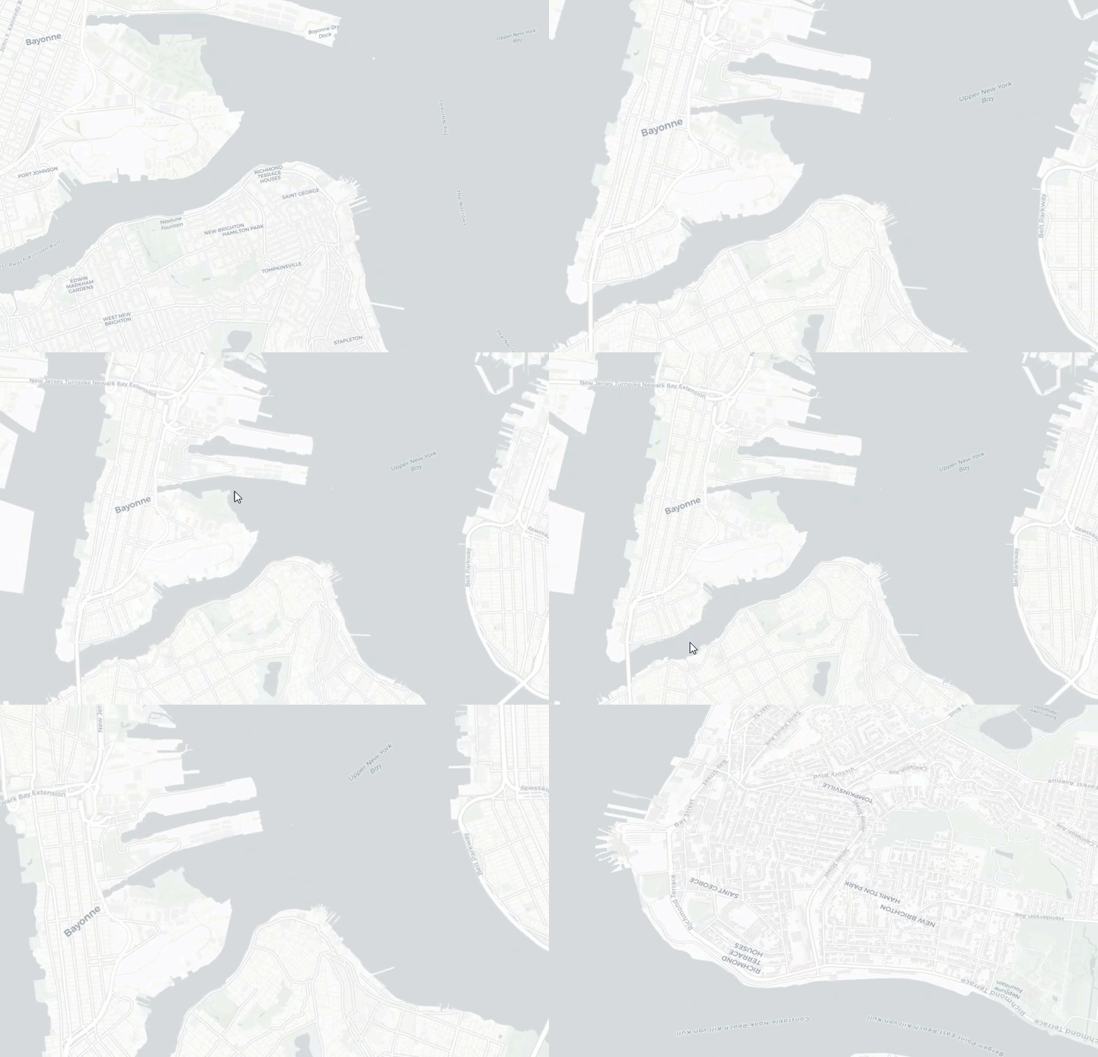
 1 function changeView() {
 2     map.animateTo({
 3       center: [-74.08087539941407, 40.636167734187026],
 4       zoom: 13,
 5       pitch: 0,
 6       bearing: 20
 7     }, {
 8       duration: 5000
 9     });
10     setTimeout(function () {
11       map.animateTo({
12         center: [-74.10704772446428, 40.66032606133018],
13         zoom: 18,
14         pitch: 65,
15         bearing: 360
16       }, {
17         duration: 7000
18       });
19     }, 7000);
20   }
46. marker animation
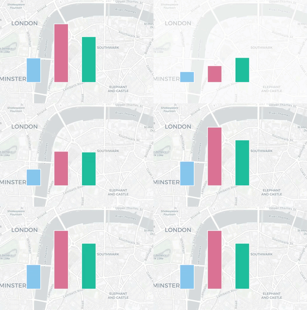
 1   function animate() {
 2     bars[0].animate({
 3       'symbol': {
 4         'markerHeight': 82
 5       }
 6     }, {
 7       'duration': 1000
 8     });
 9
10     bars[1].animate({
11       'symbol': {
12         'markerHeight': 197
13       }
14     }, {
15       'duration': 1000
16     });
17
18     bars[2].animate({
19       'symbol': {
20         'markerHeight': 154
21       }
22     }, {
23       'duration': 1000
24     });
25   }
47. move line animation
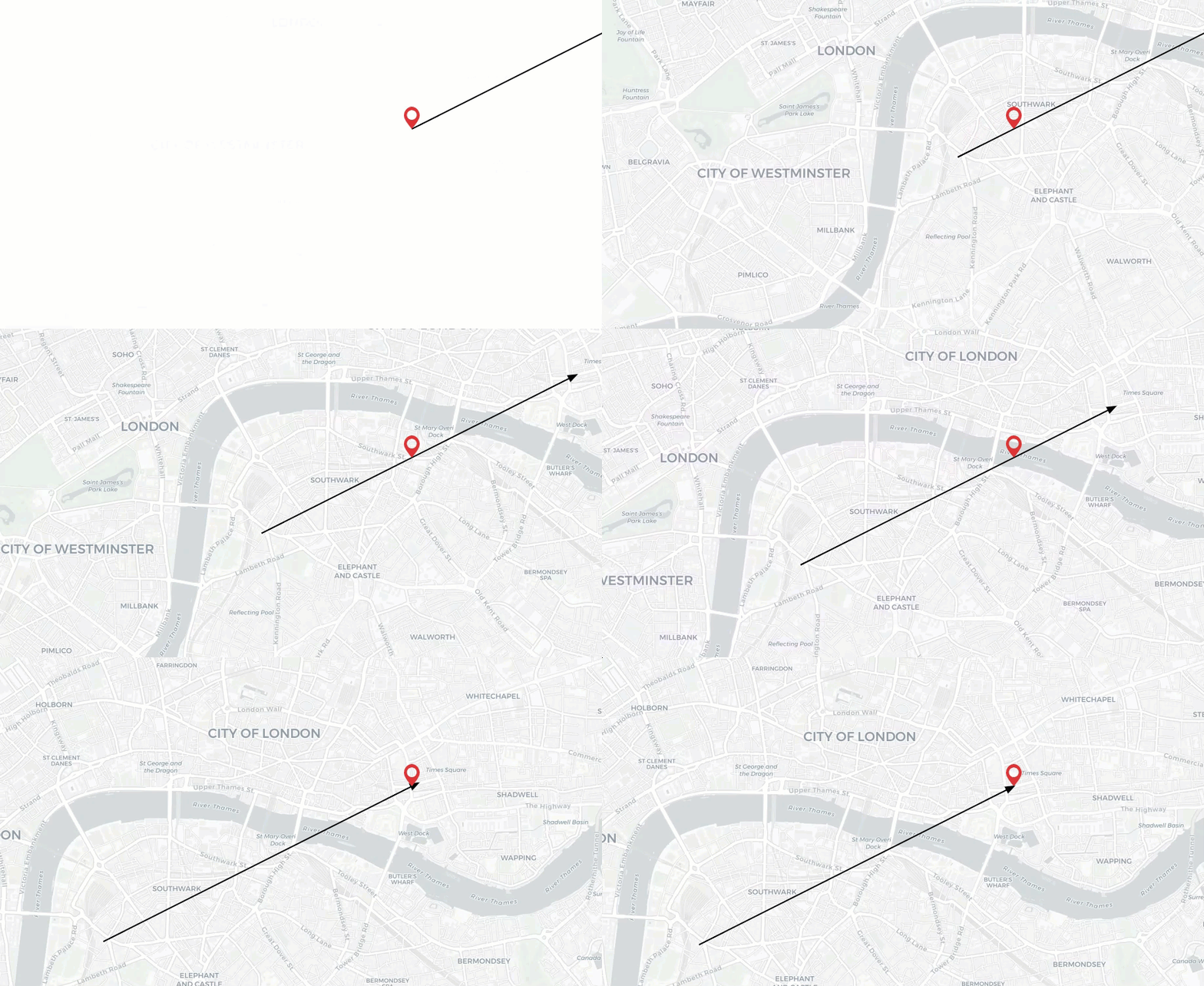
 1   function replay() {
 2     marker.setCoordinates(start);
 3     marker.bringToFront().animate({
 4       //animation translate distance
 5       translate: [offset['x'], offset['y']]
 6     }, {
 7       duration: 2000,
 8       //let map focus on the marker
 9       focus : true
10     });
11   }
48.InfoWindow
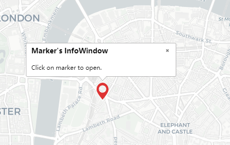
 1  marker.setInfoWindow({
 2     'title'     : 'Marker\'s InfoWindow',
 3     'content'   : 'Click on marker to open.'
 4
 5     // 'autoPan': true,
 6     // 'width': 300,
 7     // 'minHeight': 120,
 8     // 'custom': false,
 9     //'autoOpenOn' : 'click',  //set to null if not to open when clicking on marker
10     //'autoCloseOn' : 'click'
11   });
12
13   marker.openInfoWindow();
49.Custom InfoWindow
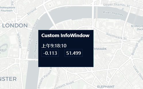
 1   var options = {
 2     //'autoOpenOn' : 'click',  //set to null if not to open window when clicking on map
 3     'single' : false,
 4     'width'  : 183,
 5     'height' : 105,
 6     'custom' : true,
 7     'dx' : -3,
 8     'dy' : -12,
 9     'content'   : '<div class="content">' +
10       '<div class="pop_title">Custom InfoWindow</div>' +
11       '<div class="pop_time">' + new Date().toLocaleTimeString() + '</div><br>' +
12       '<div class="pop_dept">' + coordinate.x + '</div>' +
13       '<div class="pop_dept">' + coordinate.y + '</div>' +
14       '<div class="arrow"></div>' +
15       '</div>'
16   };
17   var infoWindow = new maptalks.ui.InfoWindow(options);
18   infoWindow.addTo(map).show(coordinate);
50. layer switcher
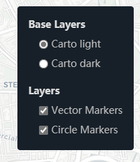
 1 var map = new maptalks.Map('map', {
 2     center: [-0.113049,51.498568],
 3     zoom: 14,
 4     layerSwitcherControl: {
 5       'position'  : 'top-right',
 6       // title of base layers
 7       'baseTitle' : 'Base Layers',
 8       // title of layers
 9       'overlayTitle' : 'Layers',
10       // layers you don't want to manage with layer switcher
11       'excludeLayers' : [],
12       // css class of container element, maptalks-layer-switcher by default
13       'containerClass' : 'maptalks-layer-switcher'
14     },
15     baseLayer: new maptalks.GroupTileLayer('Base TileLayer', [
16       new maptalks.TileLayer('Carto light',{
17         'urlTemplate': 'https://{s}.basemaps.cartocdn.com/light_all/{z}/{x}/{y}.png',
18         'subdomains'  : ['a','b','c','d']
19       }),
20       new maptalks.TileLayer('Carto dark',{
21         'visible' : false,
22         'urlTemplate': 'https://{s}.basemaps.cartocdn.com/dark_all/{z}/{x}/{y}.png',
23         'subdomains'  : ['a','b','c','d']
24       })
25     ])
26   });


