GDAL 处理shape自相交图形
背景
在ArcGIS 中无论是拓扑、shapefile文件、还是个人地理数据库都是设置有容差的,小于这个容差的自相交,都是无法检测到的。
解决办法
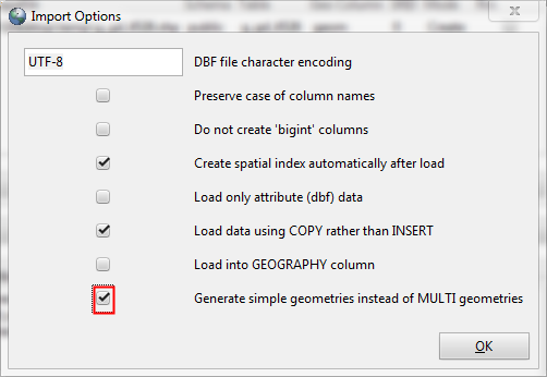
1. 通过postGIS导入工具导入shp, 并将多换设置为单环

2. 通过postGIS修复无效图形
update temp1 set geom =ST_Buffer(geom, 0.0)
--或者
update temp1 set geom =ST_MakeValid(geom)
在ArcGIS 中无论是拓扑、shapefile文件、还是个人地理数据库都是设置有容差的,小于这个容差的自相交,都是无法检测到的。
1. 通过postGIS导入工具导入shp, 并将多换设置为单环

2. 通过postGIS修复无效图形
update temp1 set geom =ST_Buffer(geom, 0.0) --或者 update temp1 set geom =ST_MakeValid(geom)
